+995 596 191911, +995 599 909020

Kakheti

Kakheti – the immortal home of beauty! The figurative expression ‘I have traveled the whole world but haven’t found your equal’ is uttered by almost everyone after at least one visit to this astonishing place.

As for those who have never been to Kakheti, they are predestined to experience this feeling. If you have decided a great journey it does not matter whether you have already been to kakheti or whether you are going to see it for the first time.

What is Kakheti? It is difficult to find an appropriate epithet for such a distinct region. The past here is interwoven with the present like a branch of wine around its pole. Your eyes will be graced by Alaverdi church that is uplifted to the skies and the wonderful Lopota Lake, fed by rain and snow. And there is much, much more…

Look to the mountains, where Old AND New Shuamta monasteries are standing silently, then walk along the tourist trail to the Vashlovani reserve; see the haughty, snow-peaked mountains of the Caucasus, with their glaciers melting in Kakheti′snear-endless Alazani Valley.

Ascend the Gombori Mountains and look at the beautiful sunset; travel to Tusheti and climb its grand towers that stand firm like mountains… the sky is so close, stretching your arms seems to be enough to touch the stars. Look at Kakheti and it does not matter which way you look. There is kindness, beauty, abundance and mercy everywhere. There is more than enough to see, and one life is not enough to see it all.

Kakheti is a historical region in eastern Georgia. It is mainly centered around basins of Iori and Alazani rivers. The region was once divided into four parts: Garekakheti (Outer Kakheti) situated in Iori Rivers basin, Kiziki – lower part oflori River, Shignikakheti (Inner Kakheti) – right bank of A lazani River. In ancient times, Kakhetias  such covered amuch smaller territory (higher parts of Iori River, between Tianeti and Ujarma) The center was initially Cheleti and afterafter 4th century – Ujarma.

The region was crossed by some importantroads. Due to its very advantageous geographical and strategic location, Kakheti served as a unifier for bordering political entities. In the early feudal period, Kakheti already covered the territories of Ertso-Tianeti and Tush-Khevsureti..by the end 8th century, Kukheti and part of Hereti were also incorporated and in 15th century, the entire Hereti became part of region. From the 11th century, the city of Telavi became the political center of the region and in 15th century this staus was passed to Gremi.

Today, according to the administrative division of Georgia, Kakheti consists of eight municipalities – Akhmeta, Dedopistskaro, Gurjaani, Kvareli, Lagodekhi, Sagarejo, Sighnaghi and Telavi; this includes the birthplace of Georgian highlanders – Tusheti.

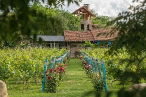
Kakheti is one of the cradles of winemaking. This peculiarity greatly influences traditions and culture of the region, creates its unique, picturesque character and, at the same time, adds special traits to the whole historical and ethnographic picture of Georgia.

Kakheti also has a big potential in terms of wine tourism.. The winemaking history of the region begins in 3rd-2nd centuries BC and up to now is the main and the most important part of its economy.

Besides, Kakheti stands out for its many cultural monuments. Lots of churches, monasteries and fortresses attract the attention  of foreign tourists. The most important cultural sites of Kakheti are: Ninotsminda church, Bodbe church, Khornabuji Fortress, Ujarma church, the walled town of Sighnaghi, Gurjaani church, Alaverdi church, Old and New Shuamta churches, Ikalto church, Gremi complex, Nekresi church etc.

Udabno poles

Location: sagarejo municipality, western part of Ivris Plateau, 500-600 meters above sea level

Access road: the length of grouns road from the village of Udabno is 9-10 km; distance from Tbilisi – 100 km, from Sagarejo – 50 km

Udabno rocky pole erected by dense Neogene limestones. On the very flat spot stands 5,2 meter-high, 2 meter-long and 1,2 meter-wide bizzare natural creature. There are many such poles on Ivris plateau.

To the south of Udabno pole, in 15 km, on the rocky mountains of Gareji is located one of the outstanding religious and cultural centers of the feudal era Georgia, David Gareja monastery complex hollowed out of the rock face founded in the first half of the VI century by one of the 13 Assyrian monks – St. David Gareji.


Takhti-Tepa mud volcano

Location: Dedoplistskaro municipality; southern part of Dali water pool, 620 meters above sea level

Access road: distance from the Dali mount waterpool is 5 km, fromfrom Tbilisi – 170 km, from Telavi – 125 km, from Dedoplistskaro – 35 km.

This is the way several meter-high whitish flat-topped hillock sitting on the parallel mountain of  Takhti-Tepi range – a mud volcano of the same name erupts and bubbles. The biggest crater diameter of mud volcano on the hillock is 3,5-4 meters. It is active like many other vents of smaller size located around it. it has non-stop eruption or spilling of gases, mud  and oil having healing qualities.

The monument of non-organic nature is part of Vashlovani preserved territory. In 5 km from the volcano to the north, in the lower flow of river Ivris is Dali mountain water pool. It is the third largest water reservoir in Georgia and its water volume runs up to 140 million cubic meters.


Pantishara canyon

Location: Dedoplistskaro municipality, the utmost eastern part of Georgia; 500 meters above sea level.

Access road: from the village of Kasristskali to the canyon leads ground road, distance os 30 km; distance from Tbilisi – 200 km, from Telavi – 155 km, from Dedoplistskaro – 65 km.

Located in Dedoplistskaro district, at the very end of the Ivris plateau, between the rivers Iori and Alazani, the territories of Vashlovani preserved territories. These zones of landscapes are as follows: desert, semidesert, steppe, arid thin forests and desidious forests. The territory encompasses Pantishara-Vashlovani massif sitting on the height of around 300-600 meters above sea level.


Alazani floodplain

Location: Dedoplistskaro municipality, to the south-east of the village of Pirosmani, river Alazani vallay, 165-190 meters above sea level.

Access road: distance from the village of Pirosmani – 5 km, from Tbilisi – 185 km, from Telavi – 115 km, from Dedoplistskaro – 55 km.

River A lazani the length of which is 407 km is the longest known river in Georgia.

The natural monument of Alazani floodplain in the Alazani valley, or Ground nuts bay is a promontory having the shape of a peninsula which is encroached into the river.


Ninoskhevi waterfall

Location: lagodekhi municipality (Ninigori community), A lazani plain, river Ninoskhevi gorge, 1300 meters above sea level.

Access road: distance from Tbilisi – 180 km, from Lagodekhi – 15 km, from Telavi – 90 km.

Fro protected territories in Georgia, the first was founded in Kakheti, on the territory of Lagodekhi district. In this marvelous gorge are distributed relict plants: Lagodekhi gentian, Lagodekhi snowdrop, primrose, bladdernut (jonjoli), wingnuts, chesnut trees etc. a traveller can come across here also such species as roe deer, deer, wild boar and birds of prey.

In 8 km past the village opens up a wonder scenery wherefrom the altitude of 45 meters falls one of the most beautiful in Georgia, Ninoskhevi water stream. Waterfall is situated in the gorge of river Ninoskhevi, that is why it is sometimes called Ninoskhevi waterfall. Passing a fern grove, it is possible to reach the top of the waterfall and see how foamed water falls and how water drops spill on the moss-grown boulders.


Lake of black rocks

Location: lagodekhi municipality, about 2900 above sea level

Access road: in the direction of Black Rocks it is recommended to use tourist route starting from the administration of Lagodekhi protected areas; distance from Tbilisi to Lagodekhi – 155 km.

In the alpine zone of Lagodekhi there are several very beautiful lakes of glacier origin. The biggest among them – Lake of Black Rocks – sits on the altitude of 2900 meters above sea level. Its depth attains 12 meters. Tourist route goes up step by step and reaches this upper border of the forest entering an Alpine zone. It is marvelous picture to see broad rhododendron-rich, wild grass islands, foggy sites and lakes from icing period making Alpine belt a breath-taking beauty.

Lake of Black Rocks is natural border between Georgia and Republic of Dagestan in the Russian Federation.


Duruji boulder

Location: to the north from the town of Kvareli, gorge of the left tributary of Alazani river – Duruji; 430 meters above sea level

Access road: distance from Kvareli – 3 km, from Tbilisi – 135 km, from Telavi – 40 km.

In the gorge of the left tributary of Alazani river – Duruji river, sits a huge limestone shale boulder brought by a landslide having the size of 5,8×4,2×4 meters. Among the displaced boulders it is the biggest in Kakheti.

River Duruji sets off on the southern slope of Greater Caucasus Mountains as a result of the confluence of Black and White Duruji rivers. The length of the river is 27 km.


Gombori cliff

Location: Sagarejo municipality, near the village of Verona; 1480 meters above sea level

Access road: near the motor road Tbilisi-Gombori-Telavi in 1,5 km from the village of Verona; distance from Tbilisi – 60 km; from Sagarejo – 62 km, from Telavi – 35 km.

Gombori range continues from the north to the south-east. Its length is 107 km. the highest summit (1991 meters) is a watershed of rivers Alazani and Ivris.

Mariamjvari State Preserve in Sagarejo municipality, on the southern slpoes of Gombori range, was founded relict Sosnovski pine-tree. Its area is 1033 ha, preserve includes also Korugi Managed Reserved Territory (2068 ha).

On the elevation of 1620 meters is situated Gombori pass connecting with this motorway inner Kakheti with outer Kakheti.


Batsara gorge

Location: Akhmeta municipality, right side of river Alazani; 750 meters above sea level

Access road: distance from Tbilisi – 140 km, from Akhmeta – 26 km, from Telavi – 55 km.

The biggest amount of conifer (yew) is preserved in the Batsari State Preserve.

Batsari sanctuary is in Pankisi gorge, to wit, in the gorge of river Batsari, right tributary of river Alazani, on the height of 700-2000 meters above sea level. In the middle part of the gorge, yew groves have survived on the area of nearly 270 ha. Such large groves of yew have no analogue in the world. Local residents call the oldest conifer `Patriarch Tree`. The age of the tree is approximately 1800 years, height exceeds 30 meters.


Natural monument in Tusheti

Location: Akhmeta municipality, left side of river Pirikhiti Alazani, 1650-4493 meters above sea level

Access road: distance from Tbilisi – 202 km, from Akhmeta – 102 km, from Telavi – 112 km, from Omalo – 12 km.

According to current admin istrative division, the whole territory of Tusheti (869 sq, km) is part of the Akhmeta municipality, Kakheti region, and includes several villages with still available fixed population. The villages are placed on the elevation from 1900 to 2400 meters above sea level. The village of Omalo is regarded as the center of Tusheti.

Villages and fortresses and towers built of local shale stone, along with natural environment, create high quality landscape values.

Otherthan historical and ethnographic monuments, Tusheti is interesting also from geographic point. For example, there is rather big formation of old travertines near the hamlet of Dartlo. They are both growing and petrified travertines.

There are a lot of healing mineral waters in the region. There are alkali salty water springs near the villages of Khiso, Shenako, Parsma, Nasoplari and Chontio.

Tusheti is home to the village of Bochorna – the highest sitting populated village in Europe (height of the center above sea level – 2345 meters).

Kakheti is the largest region of Georgia. Its area is 11 310 sq. km. the region comprises administrative territorial districts of the following municipalities: Akhmeta, Gurjaani, Dedoplistskaro, Telavi, Lagodekhi, Sagarejo, Signagi, Kvareli and ethnographic area of Georgian highlanders – Tusheti, separate districts of Kakheti are mentioned as oter Kakheti (middle basin of river Iori), Kiziqi (lower basin of river Iori), inner Kakheti (right bank of river Alazani), and Thiter area (left bank of river Alazani).

Kakheti is very diverse region. Kavkasioni (Caucasus mountains) in Kakheti is noted for its steep slopes and unforgettable scenery; between the main range and Tsiv-gombori range of Kavkasioni is located never-ending, sprawling Alazani Valley (100x35km); the Eldari Plain is the lowest place in the region (90-200 m above sea level), with semi-desert landscape. Tusheti, a region standing out for its geographic specifies and unique beauty, is situated in the Nourthen part of Kavkasioni;

Kakheti is the land of grapes. The fifth part of vineyards in the nation belong to Kakheti while grapes grown here amount to the half of grapes harvest in the country. There are well-known microzones of wine production: Tsinandali, Teliani, Napareuli, Vazisubani, Mukuzani, Akhasheni, Gurjaani, Kardenakhi, Tibaani, Kindzmarauli, Manavi, Eniseli and Gremi


Resort of Arkhiloskalo

Location:  Eastern part of Iori Plateau (Shiraki Valley)

Distance: 35 km from Dedoplistskaro, 120 km from Telavi, 160 km from Tbilisi

Sea level: 670 m

Landscape: plain, hillocky

Climate: dry, subtropical, winter moderately cold, with rear snow, mean temperature in January 2 degrees centigrade, summer very warm, mean temperature in August 23 degrees centigrade

Average annual precipitation: 544 mm

Average comparative annual humidity:76%

Duration of annual sunny light:2300 h.

Natural treatment factors: climate of low mountains and valley

Types of therapy: mineral water baths, passive climate therapy

Diseases for treatment: urinary and sexual system disorders – cystitis.

Dedoplistskaro municipality is part of a historical Georgian of Kisiqi and one of the largest administrative districts of Kakheti. The bulk of this district goes to Iori Plateu whereby in its ultimate Soth-Eastern part, on the left bank of river Iori is located Eldari Lowland this is the only place in Georgia with a genuine half-desert landscape.

In the middle of the basin of rivers Alazani and Iori is a big Shiraki plain which is bordered by low hills of Kochebi, Nazarlebi, Shuanamta and Arkhiloskalo-Kashi. The whole territory of thie plain (length 35 km, width 15 km) is used for growing and harvesting grain.

Near the bank of Alazani, on the Shiraki plain, three villages were established by highland residents in the XIX c.: Zemo Kedi, Kvemo Kedi and climate resort of low mountain – Arkhiloskalo. Arkhiloskalo is a borderline village. In Soviet period here was a military unit base. Its heritage is now a flashpoint for tourists to visit.

In Arkhiloskalo was operated nephrology health center for children where diseases of urinary and sexual system were treated.


Resort of Akhtala

Location:  Alazani vally

Distance: 25 km from Telavi, 145 km from Tbilisi

Sea level: 410 -430m

Landscape: plain

Climate: moderately continental, winter mild, mean temperature in Jenuary 0,9 degrees centigrade, summer very warm, mean temperature in August 23 degrees centigrade

Average annual precipitation:741 mm

Average comparative annual humidity:72%

Duration of annual sunny light:23100 – 2200 h.

Natural treatment factors: climate of low mountains

Types of therapy: mud baths, vaginal and rectal tampons, passive climate therapy

Diseases for treatment: musculoskeletal diseases.

In the Gurjaani minicipality, in Akhtala cavity is situated the most famous therapeutic mud quarry. There are nine outlets of therapeutic mud on the area of 405 hectares in Akhtala which are closely connected with each other, although they never act together.

The mud itself is of grey color and has fluid consistency, it includes mineral water. Temperature of mud is also changeable and it depends on the temperature of air. That is why the mud is the warmest in July and August and the coldest – in December and January.

Many times ago there was a big earthquake here that took village to the heil. In place of a village, a lake was formed.

The first therapy building in Akhtala was constructed back in 1836. It was a unit of Tbilisi military hospital.

Nowadays Akhtala mud is in intensive use at Tbilisi Spa Resort. It is planned to revive old infrastructure and renovate the resort in Akhtala itself.


Dartlo

Tusheti includes five communities: Chanchakovani, Chagma, GOMETSAURI, Tsovata and Pirikita. There are more than 50n hamlets united in the communities. In all Thushetian hamlets one can see fortress towers earmarked for refuge and alarm purposes which were used for living and taking refuge against trbes invading from the north.

The hamlet of Dartlo is spread in the community of Pirikita, 15 km away from Omalo, on the left bank of Pirikita Alazani river. In Dartlo and Kvavlo survive several, 5-6 level, 20 m height, military fortress-towers built with shale and mortar. There are gun slits, windows and sunshades on levels.

Other than Tusheti, Lashauri cult was distributed across Pshavi, Khevsureti, among the North Caucasus mountaineers. Tradition of worshipping heathen cult Tushetians inherited from Pshavs. After expansion of Christianity (IX c.) heathen cult merged with Christian tradition.

Dartlo one of the biggest villages of Tusheti. There is a XIX century church in the hamlet while beside it is a side of worship of Yakhsari Icon which is an altar-type structure of mixed heathen-christian character.


Vashlovani National Park

Preserved Territories of Vashlovani (total area – 10 142 ha), stuck between two major rivers of Kakheti – Iori and Alazani include State Reserve, NATIONAL Park (area 25 114 ha) and tree uniqua monuments of nature – Alazani grove, Artsivi (eagle) Gorge and Takhtitepa mud volcanoes.. Preserved territories was established for protection of species of plants and animals distributed in this territory.

Vashlovani is one of the most arid places in whole of Georgia.. 13 wood species of them are listed in the `Red List` of Georgia. There are many plants cultivated in Eastern Georgia that are genetic predecessors of wine, hazelnut, peach, mulberry and grain.

Vashlovani preserve is a natural habitat for 46 species of mammals. Among them is even bear rare for semi-deserts. Preserve is rich also with ornithological point: here we find thousands of flocks of birds, namely starlings, rosy starlings, sparrows, goldfinches, chaffinches. Steep grooves of Vashlovani are called `City of Swallows` since here swallow colonies made their nest. There are also lots of partridges, Kolkhetian pheasants, even Black Francolin has its habitat there, though in small scope. From predators are represented Eastrn Imperial Eagle, voltures, gyps, haeks and buzzards. Vashlovani is an ideal place for bird watching.

For sports fishing lovers on the territory of preserve, in Mijniskure, fishing with rods and nets is permitted. There are up to 20 pecies of fish having habitat in Alazani river, including:cat-fish, carp, bleak, barbell, Caucasian herring. The most poisonous snake of the Georgian fauna – Lebetine viper is also distributed in the park.

There is one more Preserved territory on the area of Dedoplistskaro municipality – Chacuna Managed Reseve Territory with rare grove forests. The area of Managed Reserve is 5200 ha. Due to farming of human beings grove forests in Georgia are nearly wiped out.


Resort of Zinobiani

Location:  Alazani river gorge

Distance: 40 km from Telavi, 160 km from Tbilisi

Sea level: 450 m

Landscape: plain

Climate: moderately humid, winter mild without snow, mean temperature in January 1 degrees centigrade, summer very warm, mean temperature in August 23-25 degrees centigrade

Average annual precipitation:600-800 mm

Average comparative annual humidity:72%

Duration of annual sunny light:2300 h.

Natural treatment factors: climate of low mountains, sulfide, carbonate-hydro-carbonate-chloride sodium-calcium mineral waters with general mineralization 0,9 g/dm3

Types of therapy: mineral water baths, passive climate therapy

Diseases for treatment: musculoskeletal, pheripheral nervous system and skin diseases as well as disorders of metabolism.

In Kakheti compared with other regions of Georgia resort areas are in less numbers, but in this respect Kvareli municipality is an exception. There are several springs of mineral water there.

Village of Zinobiani is a spa resort situated on Alazani plain, several kilometers away from Kvareli. This small townlet was founded by small sub-ethnic group of Christian Albanians – Udians who had moved from Azerbaijans Nukhi district in 1924. Two types of mineral water flow on the surface from the ground in Zinobiani and are recommended first of all to heal musculoskeletal diseases.

In Alazani plains community of Gremi there is one more mineral water spring. This is the village of Shakriani to which people gave the moniker of the `water for itching`. Shakriani mineral water with temperature attaining 26 degrees centigrade is used for therapy of joints, cardiovascular system, peripheral and vegetative nervous systems; it is also recommended for healing cystits and chronic prostatitis, as well as endocrine obesity.

On the territory of Kvareli munisipalty there are lots of monuments of cultural heritage. Among them is Nekresi – ancient township where one of thirteen Assyrian fathers – Abybos Nekreseli did his missionary work.


Telavi

Location: Alazani plain

Distance: 90 km from Tbilisi (from Gombori range)

Sea level: 550-800m

Climate: middle mountain climate, winter mild, with low snow cover, summer moderately warm, mean temperature in year – 12 degrees centigrade

Average annual precipitation: 700-800 mm

The town of telavi is administrative and economic center of the Kakhetiregion. In XVII-XVII centuries the town was the capital of the Kingdomof Kakheti. In downtown of Telavi survives the residence of Kakheti kings which bears the moniker of `Batonis Tsikhe` (Fortress of Master). The complex includes two churches, royal palace, bathhouse, tunnel, fortress and 5-meter wall where residents of the town found refuge during hostile invasions.

Georgia is a wine land, and Telavi is the most important vineyard and wine-producing flashpoint. Well-known microzones of wine-making are part of this culture: Tsinandali, Teliani, Napareuli, Vasiubani, Mukuzani, Gurjaani, Kardenakhi, Tibaani, Kindzmarauli, Manavi, Eniseli, Gremi. Wine prodused from grapes grown in these microzones is characterized by taste specific and typical for these places.

Tsinandali is the best known and popular Georgian wine. The microzone is situated in Telavi, on the right bank of Alazani river and includes villages: Akura, Vanta, Busheti, Kvemo Khodasheni, Tsinandali, Kondoli, Shalauri, Kurdgelauri, Vardisubani. Light straw-colored, dry wine Tsinandali has been prodused since 30-ies of the XX century from Rkatsiteli and Kakhuri Mtsvane varieties of grapes.

From Georgian wines preserved in the collection the oldest is Saperavi of 1841.

River Lopota rises on the height of 2560 m on the south slope of Andarazani range. As it flows, it gets waters of some other tributaries and joins river Alazani from the left bank 33 km away h – 4 m. trees, river Lopota water created artificial lake with the girth 1 km and maximum dept. in 2008 recreational zone was built on the banks of the lake. Nowadays several hotels operate here. Lake is used to breed fish including common carp, cat-fish, sturgeon. The lake is surrounded by cycling lane.


Tusheti

Location: Southern slope of a mai watershed of Greater Kavkasioni mountain range, gorge of river Story

Distance: 55 km from Akhmeta, 65 km from Telavi, 145 km from tbilisi

Sea level: 1800m

Landscape: mountainous

Climate: middle mountain climate, winter cold, with not very high snow cover, mean temperature in January 5 degrees centigrade; summer cool, dry, mean temperature in August 14,8 degrees centigrade

Average annual precipitation: 1400 m

Average comparative annual humidity:55%

Duration of annual sunny light:2400-2500 h.

Natural treatment factors: middle mountain climate and slightly sulfide chloride-carbonate and hidro-carbonate and sodium mineral waters with sulpuric and silicon acid contents

Types of therapy: mineral water baths, passive climate therapy

Diseases for treatment: diseases caused by endocrine system and metabolism disorders, as well as musculoskeletal system disorders, gynecological and urinary and sexual system disorders.

Tusheti is located in north-east of the nation, on Nourthen slopes of Kavkasioni mountain range, at 1650-4493 m above sea level. To the west it is bordered by Khevsureti, to the south – by Kakheti and to the north – by Russian Federation: Dagestan and Chechnya. From the administrative point Tusheti is part of Kakheti region, namely, Akhmeta municipalty.

The only automobile road leading to Tusheti starts from Kakheti, in the village of Pshavli, and proceeds to the highest pass in Georgia – abano pass to reach Omalo. This road is operable only for several months of the year – from May to the end of September and during this period it is cleaned several times from landslides and rock fall.

Tushetians seem to have moved to this area in IV c. BC from Pshav-Khevsureti, settled in river gorges and started their traditional business – sheep and cattle breeding. Since the beginning of the XX century due to hard domestic conditions Tushetians started to move to village of Alvani and how the Alvani situated in Kakheti became the territory of Tusheti.

Tusheti is divided in two parts by Makratela slope: on one side is Gometsari gorge where Gometsari Alazani river flows, and on the other side – Pirikita Tusheti with Pirikita Alazani.. here one can enjoy unique pine groves, breathtaking alpine and sub-alpine meadows, pristine rhododendrons, glaciers, Caucasian goat distribution areas, and remnants of villages. There are lots of small lakes with diameter of no more than 20m, and marshlands which shaped up presumably as a result of drying of such small lakes. Some rivers partly freeze in winter.

In the beginning of a road leading to Tusheti, near Abano pass in the gorge of river Stori, in one spot there are outlets of 13 warm mineral waters. This place is called Torgva Baths, in commemoration of popular hero Torgva.

For many years climatic spa resort was operated at the outlet of mineral waters where various ailments were treated with water baths and passive climate therapy.


Tusheti national park

Tusheti National Park (69515 ha) and Tusheti Protected Landscape (31518 ha) are largest preserved territory in Europe. Diverse natural conditions of Tusheti – predetermine both multiple types of fauna and endemic character of distributed species. 11 species of flora disseminated here are endemic to Georgia and 230 – to the Caucasus and enlisted in the `Red Books` of Georgia and overseas.  Nowhere in any other places are registered forest types distributed in Tusheti – birch and pine trees with subalpine bush weeds, birch and lime trees wiTth weeds, pine-trees with flax. Pine is available in Tusheti on the height of 2700 m above sea level thaugasus. at is unique case for the Caucasus.

Tusheti protected Landscape includes Tusheti villages, summer cabins of shepherds and surrounding territories in the gorges of Pirikiti Alazani riverand its tributaries, summer cabins and surrounding territories situated in the North slopes of Greater Kavkasioni mountain range and near Diklo Mountain. The purpose of setting up Protected Landscape was to preserve traditional image of Tusheti villages as well as protection of environment from damage that may be caused by expansion of tourism and traditional business development.


Resort of Lagodekhi

Location:  vally of river Lagodekhiskhevi

Distance: 25 km from Telavi, 155 km from Tbilisi

Sea level: 460 m

Landscape: plain,

Climate: low mountain, moderately humid climate, winter mild without snow, mean temperature in January 0,9 degrees centigrade, summer very warm, mean temperature in August 24,1 degrees centigrade

Average annual precipitation:1076 mm

Average comparative annual humidity:72%

Duration of annual sunny light:2300 h.

Natural treatment factors: climate of low mountains, sulfide, chloride, sodium mineral waters with general mineralization of 0,44 g/dm3

Types of therapy: mineral water baths, passive climate therapy

Diseases for treatment: musculoskeletal diseases.

Lagodekhi municipality is located in the North-East of Georgia on Alazani Valley, on the border of three countries –  settlements in Kakheti. Georgia, Azerbaijan and Russia (Dagestan region). This is one of the oldest settlements in Kakheti. Lagodekhi is noted for its sulphur mineral waters that are used for healing and disease preventive purposes.

In 1912 in the vicinity of Lagodekhi the first protected state territory in Georgia was set up with the area of 3500 ha. Nowadays lagodekhi preserved territory includes Lagodekhi State Reserve (22 266 ha) and Lagodekhi Managed Preserved Territory (1 992 ha) and along with protection of nature it serves the function of educational and recreational center.

Visibly dissected relief, big sway of heights, slopes of various titles and exposition, and deep gorges with rivers create diverse physical and geographic conditions and cover of vegetation. Two thirds of plants distributed in Georgia are available here. Above 2300 m evergreen rhododendron shrubbery is distributed. 121 species of flora of Preserved Territory are endermic in Caucasus and 9 – in Georgia.

Lagodekhi Preserve is home to the most species of predator and even-toed ungulates distributed in Georgia. Preservers bird fauna also stands out.


Omalo

Location: between Greater Kavkasioni mountain range and Pirikita slope, on the right bank of Pirikita Alazani river

Distance: 100 km from Akhmeta, 110 km from Telavi, 200 km from tbilisi

Sea level: 1800m

Landscape: mountainous

Climate: middle mountain climate, winter cold, long-lasting, with higher snow cover, mean temperature in year – 6,8 degrees centigrade; summer moderately warm, dry, mean temperature in August 14,8 degrees centigrade

Natural treatment factors: middle mountain climate and slightly sulfide chloride-carbonate and hidro-carbonate and sodium mineral waters with sulpuric and silicon acid contents

Types of therapy: mineral water baths, passive climate therapy

Diseases for treatment: diseases caused by endocrine system and metabolism disorders, as well as musculoskeletal system disorders, gynecological and urinary and sexual system disorders.

Omalo –the largest village and administrative center of Dusheti – is divided in two parts: Old and New Omalo. Old Omalo, or Keselo Fortress, is a monument of XVIIIc. 3-4 level low and wide towers were built primarily from shale, drily, without mortar, and roofed also with shale. Only several towers survived up to the present. In one of the towers was arranged Museum of Etnology where Tusheti domestic utensils and military weapons are displayed.

In Omalo, like the whole of Tusheti, one can see many medicinal mineral water springs: there are tree mineral water outlets naturally flowing out of the ground. One of them – `chigo water` – is very salty and contains chlorides; at the foot of Vedzi mount is an outlet of two springs, alkali salty waters are available near Khiso, Shenako, Parsma, Nasoplari and Chonto; near Diklo there is a sulfur water spring, and in the vicinity of Dochu and Khakhabo there are springs containing iron. These waters have not been the object of study and trails by scientists, yet.

Since 70-ies of the last century, in July and August, near Keselo Fortress popular festival called `Shepherds Day` (Tushetoba) is held. Holiday reflects the main business of the Tushetians – sheep breeding. On this day shepherds are usually awarded and traditional Tushetian games are featured. Tushetian women who have mastered the art of weaving and felting usually display carpets made in special geometric style and natural colors, multi-colored socks, knitted shoes – `Chiti`, hats of felt capes and thick felt items. Part of the festivities is a concert of Tushetian folklore with Tushetian accordion and songs. Guests of the festival can follow the process of brewing of Tushetian beer, making of khinkali (Georgian meat dumplings) and Tushetian gouda (cheese). The smallest participants compete with each other in painting on the shale with paints and brush. Tushetoba is a genuine popular festival.


Signagi

Location:  South-Eastern slopes of Gombori Range

Distance: 60 km from Telavi, 100 km from Tbilisi

Sea level: 720 m

Climate: mild and humid, winter mild with no snow, mean temperature in January 2 degrees centigrade, summer very mild, moderately humid, mean temperature in August 24,3 degrees centigrade

Average annual precipitation:810 mm

Duration of annual sunny light:22300 h.

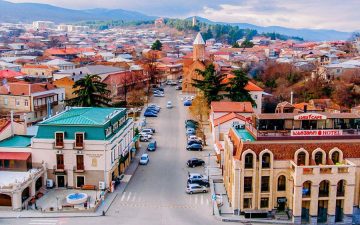
Signagi, the heart of Kiziqi which is the most picturesque corner of Kakheti, is lying on the South-Eastern slopes of Tsiv-Gombori range. Its elevation from the Valley is 400 m. like Telavi, the townie was considered the king’s estate. The foremost geographic location gave Signagi a strategic importance. That is why the townie was shaped up as a venue of craftsmen and merchants.

After the fall of Hornabuji, Signagi became the center of Kiziqi and important town. In 1762 king Erekle II turned it into a royal residence and surrounded it with a wall surviving up to the present nearly unchanged. The wall encompasses an area of roughly 40 ha and is the largest fortified structure in Georgia.

Today the sights of the town include several museums, namely, Museum of Archeology and Ethnology which houses a unique collection of a self-educated artist, Niko Pirosmanashvili. In the fall, a wine festival is usually held in Signagi where wineries and alcohol-producing companies of Georgia present their products – wines of Kvevri (clay vats), wines produced in European-style and Georgian farmers (so called `peasants`) domestic wines. Festival also hosts specimens of popular handicrafts – felt, quilt, rugs, carpets, flutes and panduri (three-stringed national lute).

The wall of Signagi was erected without foundation, with cobble stone, sand and limestone. The wall has two level. There are 3-story towers built in the wall. The towers bear the names of Kiziqi villages.

The nunnery of St Nino and Episcopal center of Bodbe (Kiziqi) Eparchy is 2 km away from Signagi. The monastery was built in IV c. on the tomb of St. Nino who baptized Georgia. Bodbe is home to active monastic life. due to priers of St Nino, there is ablution site and a small church and every day it is visited by crauds of people.


Resort of Ujarma

Location:  South-Eastern slope of laino range

Distance: 22 km from Sagarejo, 55 km from Telavi, 35 km from Tbilisi

Sea level: 960 m

Landscape: mountainous

Climate: Georgian low mountain climate, with big swings in temperature, winter mild with rare snow, mean temperature in January 0 degrees centigrade, summer very warm, mean temperature in August 22 degrees centigrade

Average annual precipitation:600 mm

Average comparative annual humidity:63%

Duration of annual sunny light:200 h.

Natural treatment factors: climate of low mountains and hyper-thermal carbonate-hydro-carbonate-chloride sodium mineral waters with high content of bromide, iodine, silicon acid with general mineralization 8,0-10,0 g/dm3

Types of therapy: mineral water baths, passive climate therapy

Diseases for treatment: musculoskeletal diseases.

22 kilometers away from Sagarejo, on the bank of river Iori, is situated historical village of Ujarma. Town was built – on the spot of a fortress of XXc. Here was one of the residence of a great Georgian king, Vakhtang Gorgasali.

The most important natural resource of Ujarma is iodine-bromide therapeutic waters discovered by the geologists during works in 1962. Hillocky territory of the resort is covered with rich forest. Dry continental climate with healing of waters provides excellent effect in treating peripheral nervous system and cardiovascular system diseases. Since 1963 rest-house Ujarma has been operating in Ujarma. In the hamlet of Mukhrovani, 2 km away from Ujarma, is a small salty lake where curing mud is available.

There are two more resort areas on the southern slope of Tsiv-Gombori range: Tsivi Koda (1600 m above sea level) with mountain climate with forest and good respiratory organs, including closed form of tuberculosis, and Gombori (1665 m above sea level) where Outer Kakhetians and visitors to kakheti like time spent in hot summer months. Resort is recommended for treatment of bronchitis, lymphodenitis, blood anemia.


Kvareli Lakes

Location: Alazani plain

Distance: 30 km from Telavi, 150 km from Tbilisi

Sea level: 430 m

Landscape:plain

Climate: moderately humid, winter mild, without snow, summer very warm, mean temperature in year 14-16 degrees centigrade

Average annual precipitation: 900-1000 mm

Duration of sunny light: 2200 h.

River Duruji flowing on the Southern slope of Kavkasioni emerges due to the flow of Blck and White Duruji tributaries. Its total length is 27 km.Duruji gets its feed from snow and rain water. In 1899, from its rise to Kvareli on the distance of 6-8 km river Duruji carried a huge boulder. Limestone boulder turned into shale up to the present lies near Kvareli. Its size is 5,8×4, 2×4 m and weight about224 tons.

5 km to the east from Kvareli, a reservoir was created by damming of river Duruji that in commemoration of a great Georgian Writer Ilia Chavchavadze, was given moniker of `Ilia’s Lake. The lake became a leisure and recreational center. From one side it surrounded by hillocks covered with forests, from the other side there is recreational park with attractions and playgrounds and very beautiful amphitheater, lakeside is accompanied by an alley with several cafes and restaurants. The lake is situated in the micro zone of famous semi-sweet wine variety called `Kindzmarauli`.

Kvareli lake is located to the east from Kvareli, on the southern slopes of Kavkasioni, several kilometers away from Ilia’s lake. It was created by damming of rivers Bursa and Chagurgula. `Kvareli lake is an important recreational zone of Kakheti.

`Ilias lake recreational zone comprise 800 m lakeside boulevard, 3-km lane for cycling, amphitheater for 1400 spectators, well-organized lake shore, basketball ground and soccer pitch.

Kakheti is famous for its vineyards and noble wine. Traditional dishes of Kakhetian cuisine are: Mtsvadi (barbeque), Khashlama, Chakapuli, Chikhirtma, etc. KakhetianMtsvadi is distinguished by its taste. Meat should be chosen correctly and then roasted on tsalami – dried twigs of wine, which gives unusual taste to this dish. Delicious sweets – Tatara and Churchkhela are made of Badagi – grape juice. Sort of long bread – Shoti, specialty of Kakheti is baked here.

Copyright © 2018 - 2022 · Giko Travel ltd. All Rights Reserved