Book reliable car rentals anywhere in Borjomi, Georgia, with flexible pickup spots, affordable rates and 24/7 support. Reserve online now at Cars & Rooms today.
Book Now From Borjomi Car Rental Anywhere

- Pick-Up: 50 USD
- Return: 50 USD
- Early Pick-Up: 50 USD
- Late Return: 50 USD
- Mondays: 08:00 - 20:00
- Tuesdays: 08:00 - 20:00
- Wednesdays: 08:00 - 20:00
- Thursdays: 08:00 - 20:00
- Fridays: 08:00 - 20:00
- Saturdays: 08:00 - 20:00
- Sundays: 08:00 - 20:00
What Makes Borjomi Worth the Trip?
Tucked into the green folds of the Samtskhe-Javakheti region, Borjomi isn’t just a name on a bottle of mineral water. It’s one of Georgia’s oldest and most beloved resort towns, surrounded by forested hills and historical charm. A popular spot for both locals and travellers, Borjomi is the kind of place that invites you to slow down, look up, and breathe deeply.
Founded in 1842, the town has a noble origin. The story begins with a doctor named Amirov, whose medical insight and passion for the healing properties of mineral water led to the foundation of this resort under the leadership of Yevgeny Golovin, the Commander-in-Chief of the Caucasus. Over time, influential figures like Mikhail Romanov and Mikhail Vorontsov turned Borjomi into a favourite retreat of aristocrats, artists and military officers.
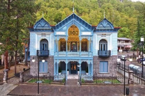
By the late 19th century, Borjomi had everything a proper resort town needed — mineral spas, villas, and even rules (no gambling or smoking near the baths!). Russia’s Emperor Alexander II even funded the construction of the Romanov Palace, which still stands as a serene, slightly mysterious monument to those golden resort days.
Why Rent a Car in Borjomi?
Let’s be honest: Georgian public transport has its charm — marshrutkas, friendly drivers, and roadside stalls selling churchkhela. But if you’re coming to Borjomi, flexibility matters. Whether you’re visiting just for a weekend or planning to explore nearby gems like Bakuriani, Vardzia, or Borjomi-Kharagauli National Park, having your own vehicle makes everything easier.
With Borjomi Car Rental Anywhere, you’re not limited to just the city centre. We can deliver the car directly to your hotel, guesthouse, or even the train station — just check with us beforehand to confirm availability and logistics.
And yes, we’re talking proper cars here. The Toyota Corolla is a great pick for comfort and fuel economy on winding Georgian roads. Prefer something a bit roomier and sturdy? Try the Toyota Matrix — it’s surprisingly versatile for mountain drives.
Our Favourite View: The Borjomi Cable Car Ride
It doesn’t matter how many road trips you’ve taken — you haven’t really seen Borjomi until you’ve seen it from above. One of the resort’s highlights is the cable car ride that soars over the Mineral Water Park and crosses the Borjomi Gorge.
You climb slowly, quietly, and suddenly the entire town unfolds below you — nestled among thick forests and curved mountain roads. On clear days, the green blanket of the Borjomi-Kharagauli National Park stretches endlessly. The ride ends near the Ferris wheel on a nearby hilltop, offering panoramic views, picnic spots, and a chance to snap the kind of photos that make your friends message: “Wait, where is that?”
Driving to Nature: Borjomi-Kharagauli National Park
Few things match the thrill of having your own car and a full tank of gas with no fixed schedule. One of the top reasons to go for Car Hire Borjomi – Delivered Anywhere is to explore this national park — one of the largest in Europe.
Forget quick detours. This place rewards curiosity. Drive to the ranger stations, pick a hiking trail, or simply find a quiet forest road where you can stop, sip coffee, and listen to birdsong. You can’t do that from the back of a marshrutka.
Personal Tip: Don’t Rush
Here’s where I speak from experience — don’t treat Borjomi like a checkbox on a long itinerary. It’s not Paris, it doesn’t try to impress you at first glance. But give it time, and it becomes a favourite.
Take the cable car. Walk slowly in the Mineral Park. Drive to Likani for sunset. Ask locals where to find the best khachapuri. Let your Corolla or Matrix sit parked for a day or two — Borjomi’s not about rushing. That’s its magic.
How to Book a Car in Borjomi
We make it simple — because holiday planning shouldn’t feel like paperwork. Whether you’re already in Borjomi or heading there from Tbilisi, our Rent a Car in Borjomi – We Deliver service lets you pick up the keys where it suits you best. Just message us in advance, so we can confirm your location and delivery options.
We’re real people behind this service. No robots, no call centres. Just a team that knows these roads — and knows how much smoother the trip gets with the right wheels.
Final Thoughts: Borjomi is Better When You Drive
You might not think of car hire as part of a relaxing holiday, but it really is. It’s not about speed. It’s about freedom. The freedom to take a detour, to explore a hidden path, to stop for a view that’s not on any list. That’s what Borjomi Car Rental Anywhere gives you.
And let’s face it — Georgia’s full of surprises. With your own set of wheels, Borjomi becomes more than a spa town. It becomes the start of a proper adventure.